The problem
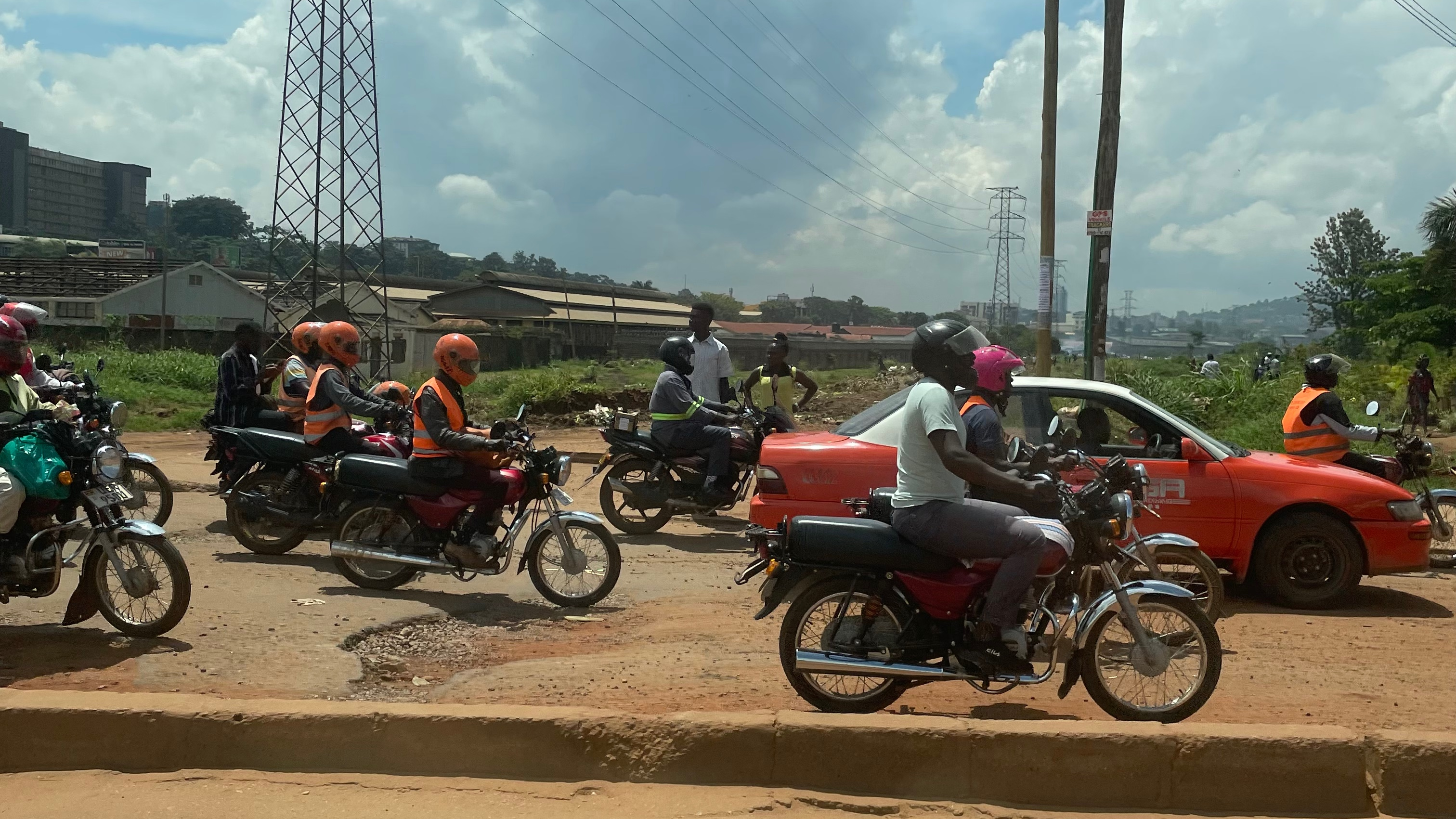
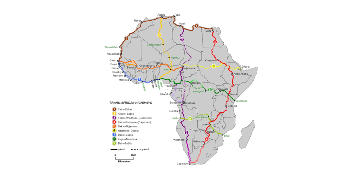
The Trans-African Highway network comprises transcontinental road projects in Africa being developed by the United Nations Economic Commission for Africa (UNECA), the African Development Bank (ADB) and the African Union in conjunction with regional international communities. They aim to promote trade and alleviate poverty in Africa through highway infrastructure development and the management of road-based trade corridors.
The main purposes of this consultancy project are:
- To define the current state of knowledge on the Trans-African Highway network and collect all the current available information.
- To point out the weaknesses and the lacks about the information available to well describe and represent the TAH network realization state of art.
- To define a methodology to better represent and describe the current state of the Trans-African Highway Network, starting from this acquired knowledge, and most of all make an update classification of Trans-African Highway Routes, using all the available information, with the possibility to acquire some additional high-definition satellite imagery to better define the characteristics and the state of the roads of the TAH network (avoiding using on-site surveys, interviews, recordings of movies filmed from vehicles driving along the roads).
The methodology must be defined, developed, and tested along two corridors:
- TAH 07: Trans–West African Coastal Highway (Dakar – Lagos Highway).
- LAPSSET Corridor – Lamu Port and Lamu-Southern Sudan-Ethiopia Transport Corridor.
Our approach
The definition of the methodology was carried out by adopting the following six steps:
- Step 1: collection of available information on TAH Network and LAPSSET Corridor (vector graph and classification based on characteristics), data and sources accuracy assessment.
- Step 2: identification of misalignment between the paths of the available vector data used for the representation of the roads and those reported by the official cartography of Google Maps and OpenStreetMap, reconstruction of the correct routes of TAH 7 and LAPSSET Corridor using QGis.
- Step 3: using QGis, construction of two dynamic spatial buffer (as functions of a certain radius r around the paths of the corridors of TAH 7 and LAPSSET), optimization of the radius r of the buffers for the two corridors (in order to include road infrastructures with a certain margin of tolerance to avoid selection errors).
- Step 4: calculation of the total area of the surface occupied by the buffers built above, check the budget availability for the purchase of satellite images from the One Atlas Living Libraries (according to the area of the buffers built previously).
- Step 5: selection and acquisition from “One Atlas” provider of satellite images identified with the above buffers for analysis, analysis of satellite images with software suitable for image recognition (in order to identify the useful features for the classification of roads and the works of art present in the road infrastructure that includes bridges, viaducts, tunnels, etc.).
- Step 6: definition, consolidation, testing, and release of the methodology developed and used for the analysis and characterization of the corridors TAH 7 and LAPSSET.