Road Analyst is a software for road assessment (or RAP, Road Assessment Programme) to evaluate performance in terms of road safety at national, regional and local level. The software uses a new simplified methodology based on the automated analysis of video images.
Road Analyst is a web based system created to assist Public Administrations, professionals and road operators in the identification of critical road sections also in the absence of a reliable database on traffic and accidents; its simplified methodology has been applied to the primary road network in Mozambique and Liberia.
Its practicability in a context like that of the African region means that such system is particularly suitable to being used in low and medium income countries.
Features
- Automated data collection: automated recognition and recording of road infrastructure from video images;
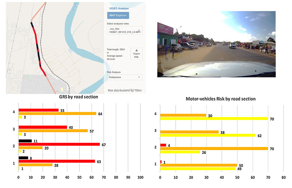
- Automated performance estimate: facilitated identification of the GRS calculation (Global Risk Solutions) and “personal” risk scores for three categories of road users (motor vehicles, cyclists, pedestrians) according to the technology implemented;
- Web based: no requirement for the installation of the software, complete compatibility with all operating systems;
- User-friendliness: simple and legible interface, the results of the risks assessed (every 100 metres) are shown on maps or tables;
- Advanced functionalities: simulation of the impact of potential countermeasures, fully downloadable results for further analyses;
- Complete documentation: guidelines are given for the video analyses and the collection of all the information supplied, and the same applies for the software installation and user manuals;
- “As a service” solutions: the service is inclusive of system customisation, training, maintenance, online and offline support, detailed reporting on the roads assessed.
Highlights
- Automated data collection: recognition and recording of road infrastructure features from video images;
- Analyse the images through Artificial Intelligence techniques;
- Generation of a road risk index (every 100 metres) for three categories of road users (motor vehicles, cyclists, pedestrians), as well as the calculation of a global risk score (GRS);
- Results of the assessed risks are shown on maps or through downloadable tables Advanced features: simulation of the impact of potential countermeasures, all outputs downloadable for further analysis.
Download product factsheet here
